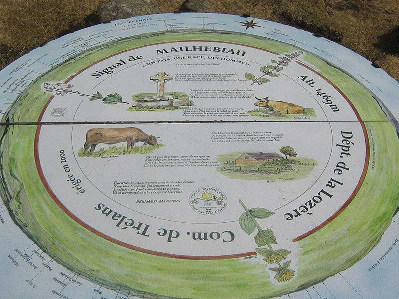
The Signal de Mailhebiau (French pronunciation: [siɲal də majbjo]; or Mailhe-Biau; Occitan: Senhal de Mailhebiau) is the highest point of the Aubrac, at an altitude of 1,469 meters.
Geography
Situation
It is shared between the departments of Aveyron and Lozère, with the summit itself located in the latter, in the commune of Trélans.
A viewpoint indicator is located at the summit, on which is inscribed a poem celebrating the beauties and the terroir of Aubrac.
Geology
Part of the mountain consists of a heavily eroded volcano that features pyroclastic tuffs containing spindle-shaped volcanic bombs. The Mailhebiau is one of the few well-identified volcanoes in the Aubrac; the others, located further north, are difficult to locate under the mass of basalt.
References